
The terrain model, also known as the ground plane, is one of the geometry files required to complete your simulation.
It’s most appropriate to include minimal detail in your terrain model. A representative flat plane is ideal if the gradient is insignificant. Otherwise, the topography should be simplified to only include the important grading around your site.
Surfaces which are part of the ground such as water bodies and unelevated roads should be included but kept as simple as possible, however, elevated structures such as highways and bridges should be separated and uploaded as surrounds. Trees and shrubberies should generally be excluded especially in the distant surrounds (beyond 50m from the study building).
Landscaping (such as trees) is currently not supported in AI. Some landscaping can be included in CFD, please visit Modeling Landscaping Features for additional information.
A few important details to look out for include:
- Ensure that the plane has no thickness or volume
- Ensure that there are no holes or disconnected sections of the plane
- Ensure that all geometry is within the terrain boundaries
- Ensure that all buildings fully penetrate through the ground and are not floating above it.
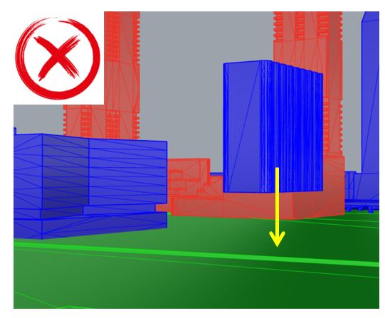
Here are some examples of the ideal terrain model vs. what is not.
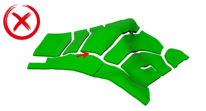
Surface contains thickness/volume and disconnected portions
Surface contains disconnected sections
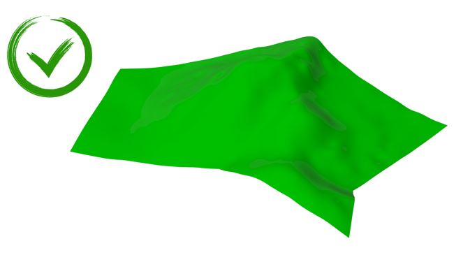
Single surface
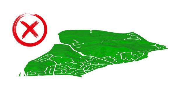
Surrounding buildings extending beyond the ground surface
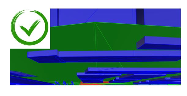
Buildings fully penetrating the ground surface
(view from the ground)
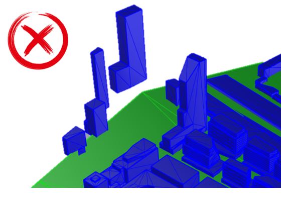
Building floating above ground surface
For additional information on preparing the rest of your geometry files, please check out our Preparing Geometry post.